
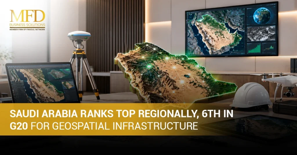
Saudi Arabia has taken a major step forward in the digital world, and this time the spotlight is on maps, data, and location technology. The Kingdom now ranks 6th among G20 nations and holds the top spot regionally when it comes to Geospatial Infrastructure Saudi Arabia has been building over the past few years. This is a big achievement, and it did not happen overnight. MFD Services has watched this journey closely, and it reflects years of planning, investment, and smart policymaking.
Back in 2022, Saudi Arabia was ranked 32nd globally in the Geospatial Knowledge Infrastructure (GKI) Readiness Index. By 2025, the Kingdom climbed all the way up to 9th place worldwide. That is a jump most countries only dream about. In this article, we will look at what geospatial infrastructure actually means, how Saudi Arabia improved its ranking, the five pillars behind this index, and what this progress means for the future.
What Is Geospatial Infrastructure?
Geospatial infrastructure refers to the systems, tools, and networks used to collect, store, and share location-based data. This includes mapping systems, satellite data, spatial information, and the digital platforms that connect all of this together. In simple words, it is the backbone that allows governments, businesses, and people to understand where things are and how they relate to each other on a map.
For a country like Saudi Arabia, this kind of infrastructure is important because it supports city planning, transport, agriculture, disaster response, and much more. As the nation grows and modernises under Vision 2030, having strong and reliable location-based systems has become a key part of national development. This is exactly why Geospatial Infrastructure Saudi Arabia is investing in today matters so much for the years ahead.
How Has Saudi Arabia Improved Its Geospatial Ranking?
Saudi Arabia’s rise in the GKI Readiness Index reflects progress in national geospatial policies, infrastructure, technology adoption, and institutional development. This did not happen by chance. Several factors worked together to push the Kingdom higher on the list, and the MFD Services team has followed each of these developments with great interest.
- Growth of national geospatial infrastructure: The country has invested heavily in building modern systems that support accurate mapping, data collection, and location tracking across all regions, including remote and rural areas that were previously underserved.
- Stronger geospatial policies and standards: New rules and frameworks have been put in place to make sure geospatial data is collected, shared, and used in a consistent and reliable way across different sectors and government bodies.
- Expansion of the National Geospatial Platform: This platform has grown to include more datasets, tools, and services, making it easier for different users to access the information they need for planning and decision-making.
- Increased use of geospatial technology across industries: Sectors such as construction, transport, agriculture, and energy have started using location-based tools more actively, which has boosted overall demand and adoption throughout the country.
- Greater government and institutional support: Various government agencies have worked together to fund, promote, and regulate geospatial projects, giving the entire ecosystem a stronger foundation to grow from year to year.
What Are the Five Pillars of the GKI Readiness Index?
The GKI Readiness Index assesses national geospatial readiness through five pillars that show the strength of a country’s infrastructure, policies, users, industry, and institutions. Each pillar plays a different role in measuring how ready a nation is to use geospatial data effectively.
- Infrastructure: This looks at the physical and digital systems in place, such as satellites, servers, and mapping networks, that make geospatial data collection and sharing possible.
- Policy Landscape: This pillar checks whether a country has clear laws, guidelines, and standards that govern how geospatial data is managed and protected.
- User Adoption: This measures how widely geospatial tools and services are used by everyday people, businesses, and government departments across different sectors.
- Industry Ecosystem: This pillar looks at how strong and active the geospatial industry is, including private companies, service providers, and technology developers.
- Institutional Capacity: This measures how well government bodies and organisations are equipped to manage, fund, and support geospatial projects over the long term.
Saudi Arabia has shown steady improvement across all five of these areas, which explains why the country’s overall ranking has climbed so quickly in just a few years. MFD Services believes this balanced growth across all five pillars is what makes the progress so sustainable.
What Is the National Geospatial Platform?
Saudi Arabia’s National Geospatial Platform brings together geospatial information and services to support government agencies, businesses, researchers, and other users. It acts as a central hub where different types of location data can be accessed and shared safely, and it stands as one of the clearest examples of Geospatial Infrastructure Saudi Arabia has built in recent years.
- Centralised access to geospatial information: Instead of searching through multiple sources, users can find maps, spatial data, and location tools in one organised place.
- Government data sharing and coordination: Different ministries and departments can share information more easily, which helps avoid duplication and improves overall efficiency.
- Private-sector access and applications: Businesses can use the platform’s data to build new tools, services, and applications that support their own operations and customers.
- Academic and research use: Universities and research centres can use the platform to study patterns, trends, and changes across different regions of the Kingdom.
- Support for planning and location-based decisions: City planners and policymakers use the data to make informed choices about roads, housing, utilities, and public services.
What Is Geospatial Technology?
Geospatial technology includes tools such as Geographic Information Systems (GIS), satellite imagery, digital mapping software, and other location-based systems that collect and analyse spatial data. These tools help turn raw information into maps and visuals that are easy to understand and use. In Saudi Arabia, this kind of technology is used in many practical ways.
City planners use it to design new neighbourhoods, engineers use it to plan roads and utilities, and environmental teams use it to monitor land and water resources. Farmers use satellite data to manage crops more efficiently, while logistics companies use digital mapping to plan faster delivery routes. As more sectors adopt these tools, the overall demand for skilled professionals and modern systems continues to grow across the country, further strengthening the geospatial infrastructure Saudi Arabia relies on every day.
How Has Saudi Arabia’s Geospatial Infrastructure Changed?
Saudi Arabia’s geospatial landscape has developed significantly through improvements in infrastructure, governance, digital platforms, industry participation, and international cooperation. Looking back over the past few years, the change has been quite remarkable, something MFD Services has observed firsthand while tracking the sector’s growth.
- Improvement from 32nd to 9th in the global GKI ranking: This jump reflects years of focused effort and investment in building stronger systems and policies.
- Development of national geospatial infrastructure: New networks, platforms, and tools have been introduced to support better data collection and sharing across the country.
- Expansion of geospatial policies and standards: Clearer rules now guide how organisations collect, manage, and protect location-based information.
- Wider adoption of geospatial technologies: More industries and government bodies are now using these tools as part of their daily operations and planning.
- Increased international cooperation and recognition: Saudi Arabia has strengthened partnerships with global organisations, which has helped improve both its G20 Geospatial Ranking and its standing on the world stage.
This progress places the Kingdom firmly among the leaders when it comes to Geospatial Infrastructure Saudi Arabia has developed, both regionally and globally.
What Does Geospatial Infrastructure Mean for Saudi Arabia’s Future?
Looking ahead, geospatial infrastructure will continue to play a major role in shaping the Kingdom’s future. Smart cities will rely on accurate location data to manage traffic, utilities, and public services more efficiently. Infrastructure planning, renewable energy projects, and environmental management will all depend on precise spatial information to succeed. Transport and logistics companies will use these tools to improve delivery times and reduce costs, while the construction sector will use mapping data to plan safer and smarter projects.
This growth also opens doors for private companies to enter the geospatial space, creating jobs and business opportunities, and firms such as MFD Services are well placed to support this next stage of Geospatial Infrastructure Saudi Arabia is set to build. As part of the broader Saudi Digital Infrastructure push under Vision 2030, geospatial technology will remain a key pillar supporting the Kingdom’s digital transformation for years to come.
Conclusion
Saudi Arabia’s journey from 32nd to 9th place in the global GKI Readiness Index, along with its 6th place G20 Geospatial Ranking, shows just how far the Kingdom has come in a short time. This progress in Geospatial Infrastructure Saudi Arabia reflects strong government support, better policies, and growing adoption of modern technology across many industries. As Vision 2030 continues to shape the country’s digital future, geospatial tools will only become more important for planning, business, and everyday life.
Teams working in this space, including MFD Services, continue to follow these developments closely, since strong Saudi Digital Infrastructure benefits everyone from government bodies to private businesses. The road ahead looks promising, and this is likely just the beginning of Saudi Arabia’s rise as a geospatial leader.
FAQs
What is Saudi Arabia’s current global ranking in geospatial infrastructure?
Saudi Arabia currently ranks 9th globally in the GKI Readiness Index, up from 32nd in 2022, and holds 6th place among G20 nations.
What is the National Geospatial Platform used for?
It is a central system that brings together mapping and location data for use by government agencies, businesses, researchers, and the public.
Why is geospatial infrastructure important for Saudi Arabia?
It supports city planning, transport, agriculture, disaster response, and many other sectors that rely on accurate location-based data.
What are the five pillars of the GKI Readiness Index?
The five pillars are infrastructure, policy landscape, user adoption, industry ecosystem, and institutional capacity.
How does geospatial technology support Vision 2030?
Geospatial technology supports smart city development, renewable energy planning, transport, and digital transformation goals under Vision 2030.